

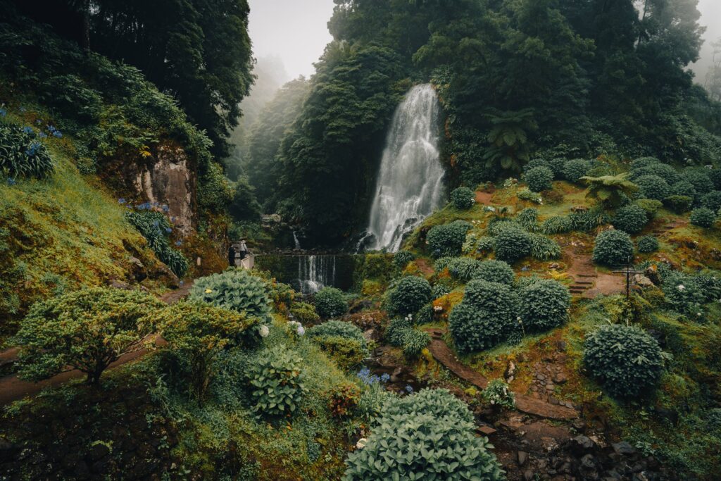
Hiking trails in São Miguel reveal landscapes that a drive around the island can only hint at. Walking beside a water channel, through woodland or along the slopes of a volcanic caldera offers different perspectives on the relationship between water, terrain and island life.
Choosing a route deserves as much attention as choosing the scenery. Distance, elevation change, ground conditions and arrangements for returning to the start all shape the experience, particularly when you want to combine a walk with other visits.
This guide brings together five hiking trails in São Miguel with different characteristics, plus an alternative for visitors who prefer a shorter stroll. The aim is to help you choose a route that suits your group and the time available, rather than assuming an appealing photograph means an easy walk.
Start by checking the official route information. Alongside difficulty, look at distance, estimated duration, the starting point and whether the route is circular or linear. A short walk may still involve demanding climbs, steps or slippery ground.
A difficulty rating does not replace an assessment of conditions on the day. Recent rain, wind and fog can change the experience considerably. Check notices and any closures before setting off.
The times below are walking estimates, rather than the total duration of your outing. Allow extra time for breaks, photographs, journeys and unexpected delays.
The Lagoa do Fogo route, identified as PR02SMI, reaches the southern shore through agricultural land, woodland, water channels and the Ribeira da Praia valley. The approach is part of the experience, with changes in vegetation and scenery along the way.
The official route information gives a distance of around 10.2 km and a duration of four hours, with a medium difficulty rating. The current description presents an out-and-back walk, returning along the same path, so follow the latest map and instructions.
Do not confuse this route with visiting the roadside viewpoints or descending from them. Prepare for the walk as an activity in its own right and set aside a substantial part of the day.
The ground can be wet or muddy, particularly beside the water channel. Stay on the marked trail and respect wildlife around the lake.
PR03SMI starts at Vista do Rei viewpoint and finishes beside São Nicolau Church in the village of Sete Cidades. Along the way, it offers views of the caldera and a closer look at the landscape before reaching the lakeside.
This is a linear route of around 7.5 km, rated easy, with an estimated walking time of two hours. However, it includes a steep descent that can be slippery, so take care with your footing.
The main practical consideration is the return journey. If you leave your car at the start, you will finish somewhere else. Arrange transport between the two points beforehand rather than relying on finding a solution when you arrive.
After the walk, allow time to explore the village and have lunch, making a day of Sete Cidades without adding too many journeys.
Serra Devassa is an option for visitors who want to explore several lakes and wetland areas on a walk through the Sete Cidades region. The route crosses open landscapes and includes an ascent of Pico das Éguas.
The current official information lists PRC05SMI as circular, covering around 9.1 km, with medium difficulty and an estimated duration of three and a half hours. Check the map before walking, as older descriptions may give a different distance.
It is a rewarding choice for spending more time among São Miguel’s lakes. The distance and climbs call for preparation for the full route, rather than treating it as a brief stroll between viewpoints.
Fog can obscure the views. Assess conditions and follow the signs, without taking shortcuts to reach a lake or viewing spot.
PRC29SMI connects the river landscape with infrastructure associated with the use of water. The route passes pipelines, hydroelectric plants and a metal walkway, and includes a visit to Salto do Cabrito waterfall.
It is a circular route of around 8.6 km, with medium difficulty and an estimated walking time of three hours. The waterfall is one stop along the walk, rather than its finishing point.
Some sections involve steps and walkways that may feel uncomfortable for people who are uneasy with heights. Consider these features when choosing the route for your group.
Visiting the waterfall alone and completing the full trail are different outings. Decide which you want to do and check access conditions, particularly after heavy rain or when weather warnings are in place.
In Faial da Terra, PRC09SMI combines a walk through vegetation with Salto do Prego waterfall and a visit to Sanguinho. The old village adds a human dimension to the landscape, with houses and small agricultural plots.
The route is circular, covering around 4.6 km, with medium difficulty and an estimated duration of two hours. It is shorter than other options in this guide, but that does not make it an effortless stroll.
There are uphill sections and a steep descent along a stone-paved path that can be slippery. Wear suitable footwear and allow time to proceed carefully.
Include the walk in a day exploring Faial da Terra and the Povoação area. Respect properties along the route and do not pick fruit from the orchards.
If you would prefer an outing with shorter walks, consider Parque da Ribeira dos Caldeirões in Nordeste. Its waterfalls, watermills and paths allow you to include some time on foot in a day exploring the region.
This suggestion is a stroll within the park, rather than one of the full routes described above. There is no single difficulty rating here, as the experience depends on the paths you choose and access conditions.
It can be an alternative for visitors who do not want to spend several hours on a trail. If you are travelling with children or people with reduced mobility, check access rather than assuming every part of the grounds is equally easy to explore.
Summer tends to be drier and brings more daylight, but no season guarantees dry ground or clear views. Spring and autumn can also offer rewarding walks, provided you choose a route that suits the conditions.
Rather than looking for an ideal month, check the forecast, weather warnings and trail conditions. Rain from previous days can affect the ground even when it is no longer raining.
Keep an alternative outing in mind. Exploring a village, garden or cultural attraction allows you to adjust your plans when a walk is no longer a suitable choice.
A walk lasting several hours deserves its own space in your itinerary. Combine it with nearby visits and avoid booking activities with tight timings immediately after your estimated finish.
A car makes reaching different starting points easier, but it does not automatically solve the return journey on a linear trail. When planning transport, consider the options at Amazing Island Rent-a-Car and arrange any transfers needed between the start and finish.
It depends on the route. Fitness, familiarity with uneven ground and comfort with steps or heights should all influence your choice. If you have limited experience, start with an option suited to your group or consider walking with a guide.
It may be possible, but your choice should take account of their age, experience and stamina, as well as the terrain and elevation changes. Do not assume a route is suitable simply because it is short.
Consult the official Azores Trails website and notices from the responsible authorities. Follow signs on site too: a route appearing in a guide does not guarantee it is open on the day of your visit.
Choosing suitable hiking trails in São Miguel allows you to explore the island more closely, among lakes, streams, woodland and villages. Give each walk time and plan your day around the route’s actual characteristics.
To organise your journeys, browse the options at Amazing Island Rent-a-Car and choose a vehicle that suits your trip. With access and return transport arranged, you can give more attention to the path and the places you discover along it.